Boulder places boulder on popular Reservoir bike route. Cyclists want answers.
For years, cyclists have used a dirt road at Boulder Reservoir as a key east-west connection around the lake. Then, one day in June, the city placed a rock in the middle of it.
Read more 🍕 Hosea Rosenberg’s new Morso opens in Boulder
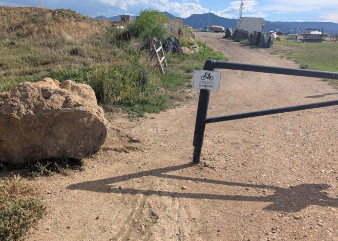
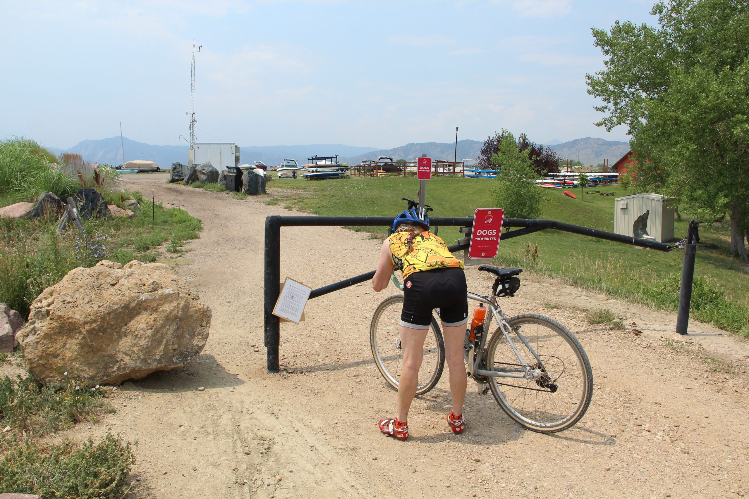
A few weeks later, the city replaced it with a larger one — a boulder — and posted a sign explaining that it was restricting access because the route is a dam maintenance road, “not an official trail.”
The boulder sits next to an existing gate blocking the road to cars. Cyclists can still ride around it through a narrow opening.
According to the city’s posted notice, cyclists entering from the east often ride into the boat trailer parking lots at high speed, creating safety issues for themselves, boaters and motorists. The notice also cites increased use by “large groups of cyclists arriving simultaneously and a notable increase in e-bikes.” City spokesperson Kate Hernandez said officials have observed “near-conflicts” in the area.
The city also argues that the route creates an equity issue because cyclists entering from the east bypass the reservoir entrance fee while still using facilities such as roads, restrooms and water access. According to the notice, that places an “unfair burden on paying visitors.”
In a July 7 blog post, Boulder Mountainbike Alliance Executive Director Wendy Sweet rejected the city’s description of the route as “not an official trail,” while saying the organization supports addressing safety concerns and unauthorized access to reservoir amenities.
“For many years, people have used this corridor to travel safely through northeast Boulder. It’s shown on official City trail maps, including the Boulder Valley Comprehensive Plan, as part of the broader trail system, and for nearly all riders it’s simply a regional connection, not a destination,” she wrote.
The route also appears as a multi-use trail on the city’s GreenStreets and Open Space and Mountain Parks maps.
Later, in response to questions from Boulder Reporting Lab, Hernandez acknowledged that the route is a multi-use trail and said the city is updating the signage “to reflect that this is a multi-use trail, and bike access is not forbidden.”
Mike Dee, executive director of the Coalition for Cyclists (C4C), which advocates for safer cycling, said the route has become increasingly popular with both recreational riders and commuters as gravel biking has grown in popularity.
“It’s an important connector point,” he said. “The fact that the [city] is making a move here is a testament to how much it’s used.”
Sweet and Dee said the city should address its safety concerns without disrupting an important regional connection. But they also said the city’s initial messaging left them unsure whether cyclists were still permitted to use the route. The posted sign referred to “restricted access” and said the road “is not intended or designed for public recreational use.”
Hernandez said that was never the city’s intent. She said access is not being restricted and that, for now, the city is simply asking cyclists to ride slowly and single file through the intersection for safety while it updates the signage.
Read more Boulder Market Meals: Fresh local zucchini turns into crispy summer fritters
Dee emphasized the need for communication with the cycling community going forward.
“I think what matters is that we have a conversation about it,” he said.
Sweet and Dee are scheduled to meet next week with Boulder Reservoir Recreation Manager Stacy Cole, who said in an email that she welcomed the opportunity to discuss the issue.
Hernandez said the city doesn’t typically conduct community outreach before implementing safety measures. “However, we could have done a better job of informing [the public] and appreciate the opportunity to lessen the confusion,” she told Boulder Reporting Lab.
The city indicated the boulder is the first step in a broader set of planned changes at the intersection.
Hernandez said the city is improving signage to make its request for slow, single-file travel clearer and is also considering adding pavement markings.
“The long-term goal is a separate path that supports folks moving around or through the Boulder Reservoir recreation area,” she said. That plan is currently unfunded.
Cyclists react
On a July 6 Facebook post by the Boulder Mountainbike Alliance about the new boulder, more than 80 comments ranged from amusement to anger.
One commenter suggested moving the boulder. Another said she had already ignored the posted notice.
“Too many words,” she wrote. “I rode right by it on Saturday.”
Others questioned how the new restriction squared with the city’s goals of building a safe walk and bike network.
“I’ve used this as a quick way to go from Gunbarrel to Boulder without getting near speeding cars that use the dirt roads,” one person wrote. Another said she used the trail to commute from Niwot.
Most commenters voiced skepticism about the necessity of the boulder.
One person said they had run and ridden the trail for 30 years and “never seen a vehicle towing a boat coming or going.”
Read more 🌎 How is Boulder doing on its climate goals? We checked.
“You want cyclists to pay for using a 1/2 mile dirt road?” he wrote.
Timeline: How the Boulder Reservoir boulder got there
- Early June: Rock appears on the dirt road used by cyclists east of Boulder Reservoir.
- June 13: The Ironman Boulder takes place.
- June 15: The rock disappears.
- June 17: The rock reappears.
- June 17: A Boulder Mountainbike Alliance bike patroller asks the city’s volunteer manager why the rock is there.
- June 18: The volunteer manager asks a ranger supervisor.
- June 22: Theranger supervisor asks Boulder Reservoir recreation management.
- June 24: Boulder Reservoir recreation management says the rock was placed to discourage cyclists from using the route.
- Late June: The city replacesthe rock with a larger boulder and adds a sign explaining the restriction.
- July 16: Cycling advocates and city officials are scheduled to meet to discuss the Boulder Reservoir boulder.